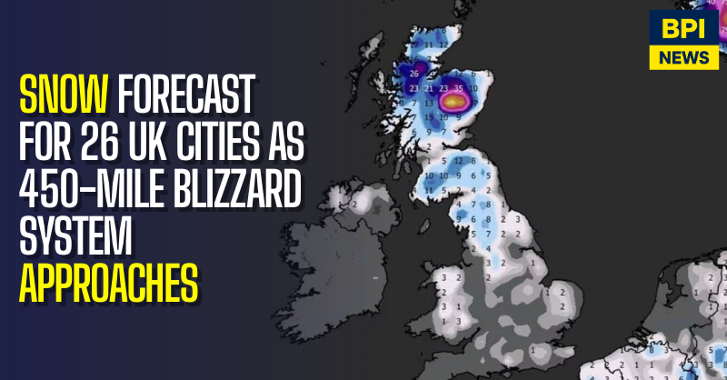
Large parts of the UK could face severe winter conditions from mid-February, with weather models indicating heavy snowfall and blizzard conditions across 26 major towns and cities.
Forecast maps published by WXCHARTS suggest a 450-mile stretch of snow and freezing weather could affect much of the country from Monday, 16 February, bringing significant accumulations in Scotland and northern England, with lighter snowfall extending into Wales and southern regions.
The heaviest snowfall is expected in Scotland, where parts of the country could see major disruption.
Cities forecast to be affected include:
- Aberdeen
- Dundee
- Perth
- Inverness
- Edinburgh
- Stirling
- Glasgow
In northern England, snowfall is forecast across several major urban areas, including:
- Newcastle
- Sunderland
- Middlesbrough
- Durham
- Carlisle
- Leeds
- York
- Sheffield
Further south, parts of the Midlands and eastern England are also expected to see snowfall:
- Nottingham
- Derby
- Leicester
- Lincoln
- Hull
North-west and central England may also be affected, including:
- Manchester
- Liverpool
- Birmingham
In western and southern regions, snow is forecast to reach:
- Bristol
- Cardiff
Forecasters say parts of central and eastern Scotland, including Perth and Kinross, could see the deepest accumulations, with some models suggesting snow depths of up to 130cm in higher areas. Aberdeenshire and Highland regions may also see heavy falls.
In England, the North East and Yorkshire are expected to experience some of the most significant snowfall, while the Midlands and southern regions are likely to see lighter but potentially disruptive accumulations.
Temperatures are forecast to fall sharply alongside the snow. Parts of the Scottish Highlands and central Scotland could see lows of around -4°C to -2°C, while much of northern England may fall to around 0°C. Wales and southern England are expected to see lows between 1°C and 2°C.
Meteorologists say the cold spell is being driven by Arctic air moving southwards, increasing the risk of drifting snow and reduced visibility, particularly in exposed areas.
The Met Office has advised the public to monitor official forecasts and warnings, noting that longer-range models remain subject to change.
Transport authorities are preparing for possible disruption to road, rail and bus services, especially in northern and highland regions. Motorists and commuters have been urged to plan ahead and allow extra time for journeys.
Local councils and emergency services are also reviewing contingency measures in case severe weather leads to school closures, power outages or access problems in rural communities.
Weather experts have stressed that while confidence is growing in a colder spell, snowfall totals and precise locations may change as the forecast period approaches.


